Overview
Last October Storm Babet ravaged the Northumberland Coast in the UK with waves up to 12m that damaged harbours, lighthouses, buoys and moorings. One of these moorings, that had been deployed by Newcastle University (UNEW), contained valuable instruments (~£10,000) along with priceless recorded data for research studying dolphin and porpoise movements.
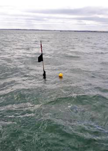
After the storm, the mooring’s surface marker buoy (see picture bellow) could not be located and the common practice of dragging a grappling hook through the area failed to catch anything. Hence the location and fate of these instruments was unknown for several weeks.
Fortunately, the mooring also included a NetTag underwater acoustic transponder developed by UNEW to locate lost fishing gear. So on the 14th Nov 2023, around 6 weeks after the mooring was deployed at sea, the NetTag Surface Location System was successfully used to pinpoint the position of the transponder. All instruments and rigging gear were recovered by pulling a grappling hook over the exact resting place of the mooring.
What is a NetTag Transponder?
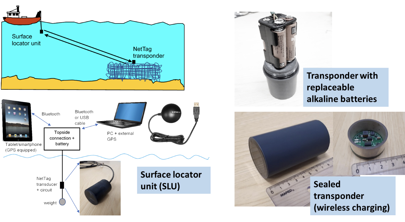
Since radio waves are absorbed by sea water, the only viable technology for locating an underwater device is acoustic communication (sound waves). An acoustic transponder is a device that “listens” for a coded “interrogation” signal transmitted from the surface and replies when this signal is detected. Unlike simple acoustic pinger devices, which continuously emit signals and hence could cause underwater noise pollution harming wildlife, a transponder is completely silent until it receives an interrogation signal from somebody trying to locate it. In addition, this two-way communication enables very accurate measurement of the range (distance) to the transponder allowing for more rapid and accurate localisation. Historically, acoustic transponders were expensive and bulky technology and mainly used in high capital applications such as offshore oil and gas. The main technological goal in the EU-funded NetTag and its follow up NETTAG+ projects is to produce acoustic transponder technology that is far more affordable, far smaller and with long battery life. This will enable the widespread tagging of fishing gear and greatly improve the location and recovery rate of lost gear.
How does the Nettag location system work?
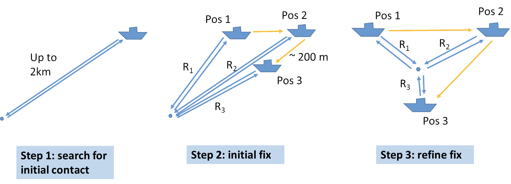
A NetTag system consists of one or more miniature, low-cost acoustic Tags (transponders), attached to a fishing gear and a Surface Locator Unit (SLU) which is deployed and operated from any available vessel. Each tag has a unique address (ID) and it will only respond to this. The SLU has an acoustic transducer which is lowered into the water and GPS receiver. It is controlled by a simple PC/smartphone app which guides the user through the location process. There are 3 steps to locating a tag:
How did the Nettag system manage to recover the instruments after the storm?
3 weeks after the storm Jeff Neasham – Professor at Newcastle University who leads the NetTag development – went out on the vessel RV Princess Royal to see if a prototype SLU could locate the NetTag transponder on the lost mooring. Surprisingly just 5 mins after arriving on site the team were able to get a fix on the transponder. In fact, they discovered that the surface line had broken and the equipment was on the seabed, about 30 m down, not far from where it was originally deployed. The NetTag system was able to give a precise position for the transponder, and the captain of the vessel was able to drag his grappling hook exactly over the top of the mooring line on the seabed to pick it up at the first attempt.
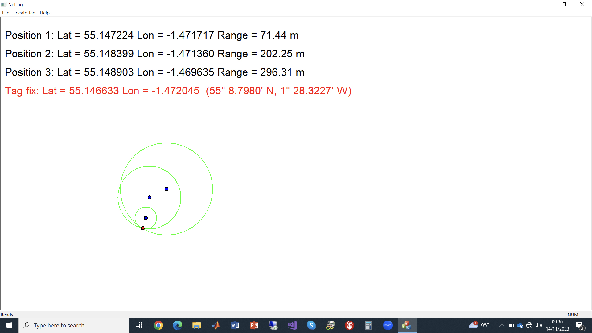
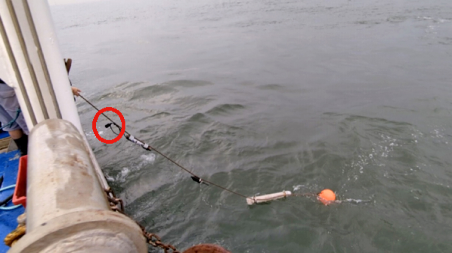
This was a brilliant result both for the NETTAG+ project and the research team working on dolphin and porpoise detection. Importantly, it was the first time that the technology has been used to recover some genuine lost “gear” at sea. With these severe storms becoming increasingly frequent in our seas, and the inevitable loss of fishing gear and other subsea assets, the value of the NetTag technology is clear. Marine Researchers at Newcastle University, and the research vessel crew, are now keen to see NetTags included on all future equipment deployments.
Finally, the sensor data that was recovered has revealed that dolphins had been active around the area of the mooring during the worst of Storm Babet providing important findings on their behaviour. Perhaps they were surfing the 12 m waves and having a good time 😊.


